Maps and Bridges
By: Karli H.
The following maps show how Ludlow grew and changed over time. For example, the maps show how new roads, housing, businesses, and industry changed the landscape of the town. One of the maps focuses on downtown Ludlow at the height of the Ludlow Manufacturing Associates, and also shows the important locations found in the downtown area. The link on Put’s Bridge tells the story about how the bridge over the Chicopee River linking Ludlow and Springfield has changed over the years.
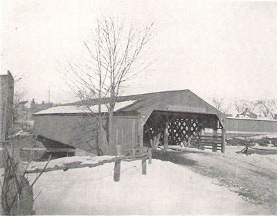
"Old Ludlow Bridge across Chicopee River,
taken from Springfield side"
The History of Ludlow, 1912